Lowell Week in Review: March 15, 2015
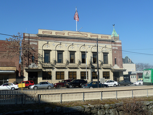
For too long our daily outside temperature was locked in the teens and any precipitation was unquestionably snow. Yesterday’s rain seemed odd, unusual, almost difficult to comprehend. It and the warmer temperatures are signs of spring and the rapidly receding snow offers hope that soon we’ll be able to enjoy time outdoors.
The council had a relatively quick meeting Tuesday night with a few important items like the Lakeview Ave shooting and funding for a new Lowell High School on the agenda. If you haven’t read my report on the meeting, please do so when you have a chance. Otherwise, there wasn’t anything particularly noteworthy that I can recall from this past week. For that reason, I want to go back to an issue that I believe is critically important for the future of the city of Lowell and that’s the Dutton Street – Thorndike Street corridor.
In the introduction to his 2012 book, Walkable City: How Downtown Can Save America, One Step at a Time, Jeff Speck contrasts a walkable city with one that isn’t. Rome is the walkable city, a “magnet for walkers,” he calls it despite its age and the absence of what Speck calls “conventional American measures of pedestrian friendliness.”
Speck’s choice of a city that isn’t walkable? Lowell, Massachusetts. Here’s what he says about our city:
A couple of years ago, while I was working on a plan for Lowell, Massachusetts, some old high-school friends joined us for dinner on Merrimack Street, the heart of a lovely nineteenth century downtown. Our group consisted of four adults, one toddler in a stroller, and my wife’s very pregnant belly. Across the street from our restaurant, we waited for the light to change, lost in conversation. Maybe a minute passed before we saw the push-button signal request. So we pushed it. The conversation advanced for another minute or so. Finally, we gave up and jaywalked. About the same time, a car careened around the corner at perhaps forty-five miles per hour, on a street that had been widened to ease traffic. The resulting near-miss fortunately left no scars, but it will not be forgotten.
Speck goes on to write that too often, urban planners equate walkability with more crosswalks and crossing lights but they’re only partly right in thinking that way. Walkability is more complicated. Speck says that to be walkable, a place must satisfy four conditions: it must be useful, safe, comfortable and interesting. He explains each of these four elements:
Useful means that most aspects of daily life are located close at hand and organized in a way that walking serves them well.
Safe means that the street has been designed to give pedestrians a fighting chance against being hit by automobiles; they must not only be safe but feel safe, which is even tougher to satisfy.
Comfortable means that buildings and landscape shape urban streets into “outdoor living rooms,” in contrast to wide-open spaces, which usually fail to attract pedestrians.
Interesting means that sidewalks are lined by unique buildings with friendly faces and that signs of humanity abound.
At the City Council Transportation Subcommittee meeting back on February 24, 2015, I and the three dozen other members of the public there to learn about the plans for remaking the Lord Overpass heard the word “walkability” spoken by the engineers and by city officials. I think they were sincere, certainly not patronizing, but I also think they are speaking a different language and define “walkability” far differently than did the members of the audience.
To the experts, walkability is measured in the width of sidewalks and the distance between crosswalks and crossing lights. To me, walkability is a more amorphous thing. It’s a little bit like the US Supreme Court Justice said about pornography: “It’s hard to define but I know it when I see it.” The same is true about walkability.
New sidewalks and a crossing light at Dutton and Fletcher is not going to make the stretch of Dutton and Thorndike Streets from City Hall to the Lowell Connector any more walkable than it is now. That will not only be a shame, it will also be a squandered opportunity to enhance an amazing collection of buildings, places and organizations that currently line that corridor. Consider what’s already there or in the pipeline:
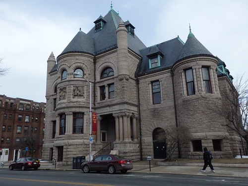
Pollard Memorial Library

Smith Baker Center
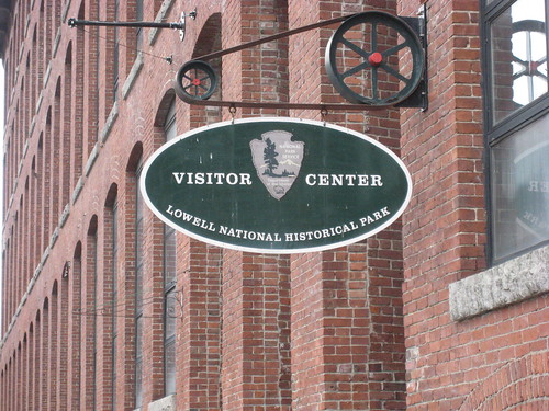
National Park Visitor Center
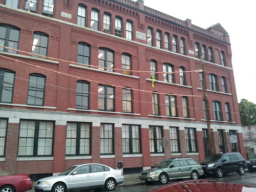
Gates Block/Arts League of Lowell
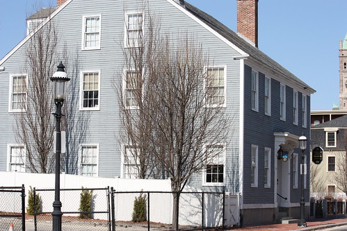
Whistler House Art Museum
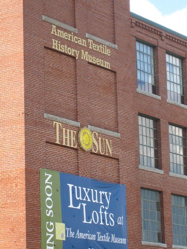
American Textile History Museum
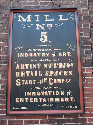
Mill No. 5

Hamilton Canal District
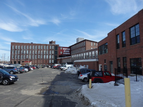
Western Avenue Studios
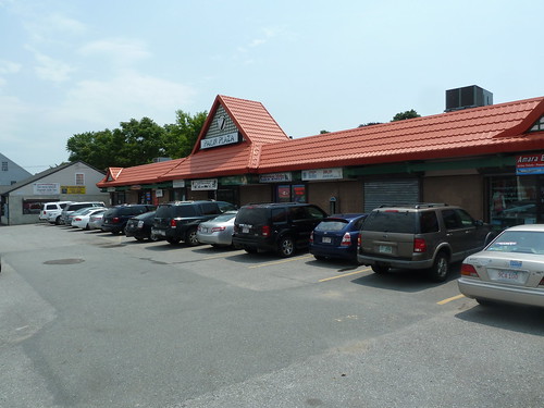
Cambodian restaurants & shops in Lower Highlands

Gallagher Terminal
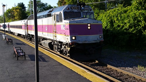
MBTA Commuter Rail Lowell Line
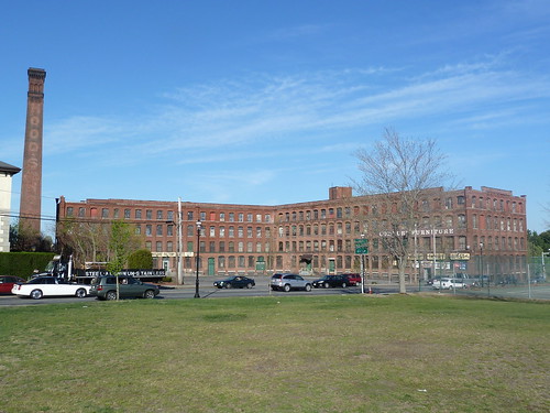
Comfort Furniture/Sal Lupoli project

South Common
This is an amazing collection of buildings, institutions and sites and all are within a few hundred yards of each other. They are natural attractions that each draw visitors in their own right. But if we weave them all together, if we make it easy and enjoyable to walk from one to another, any time of day, any day of the year, all of those institutions would benefit and the city and ALL of its residents would benefit tremendously.
So let’s broaden the discussion beyond the Lord Overpass plan. Let’s talk about making this place more walkable. I don’t know what that’s going to take, but I’m confident I’ll know it when I see it.
Unfortunately, “knowing it when you see it” is not a good way to specify changes, unless a simulation model can be developed and exercised before any shovel is put into the ground.
Dick,
Great post. Keep pushing! I wonder how many council members have read the book. I suspect not many. How about zoning, historic, and planning board members. How about the fire chief. It’s their trucks that we have to “accommodate” when planning city street after all. After reading the book and learning about New Urbanism it becomes clear as to why Lowell has struggled and what we need to do get back on top. Jane Jacobs knew in the early 60’s what urban renewal would do to cities but Lowell chose to follow conventional wisdom. Look where we ended up. Let’s stop following conventional wisdom.
Jeff Speck gave a speech at the Lowell plan breakfast in October and suggested 5 easy and specific DTL fixes to make in the near future. I haven’t seen one motion or heard anything is in the works. Can we sue the city for negligence?
There’s an article in today’s paper about the HCD and the hold-up of development because of the delay of the land swap to build a garage for cars and buses. The LRTA won’t allow the LNHP to park their buses at the Hale St facility. Craig Thomas, the city’s urban renewal project manager, said the plan had to be reworked to accommodate taller buses.
This will then cause the engineers to increase the width of the streets and size of the intersections to accommodate the buses. This will then make the HCD less walkable, less valuable, and less awesome.
Someone needs to sit down with Jim Scanlon and get him to agree to let the LNHP use their facilities. Sounds like it’s not too late. We have to get this right.
Dick,
Those are wonderful photos of buildings as they are currently. Congratulations on be such a good photographer. I wish I could take photos like those.
Jim Peters
Joe: you are right that Dick did not give build-able line items but I believe he’s on the right path; the first step is creating a vision that people can get behind.
As an engineer I am inclined to go right to problem-solving and it has taken me years to learn that sometimes that is counter-productive if done too early — a lot of times getting into details too early divides people. Once the vision is established then people are more cohesive and less likely to divide when the requirements are hashed out.
With that, excellent job, Dick, with sculpting the vision!
Great comments Richard and I agree with Mr. Peters, great photographs. Brian, I guess I am behind. I thought city, developers, and national park had come up with a garage design which would accommodate bus parking, to be located on land currently owned by Lowell NHP. What happened to that plan?
Gail,
What I’m saying is designing a garage to accommodate buses in the HCD is poor planning. Jim Scanlon says LNHP can’t use the LRTA Hale St facility because of space constraints. There is an abundance of useless green space at the facility that could be paved over to allow for greater capacity on Hale Street. Buses don’t need shelter. A pick-up/drop-off zone makes more sense given the space constraints of the HCD. We shouldn’t just accept Jim Scanlon’s determination and allow the HCD garage and streets to be over engineered.
The hard cost of building a garage to accommodate buses will be great but the opportunity cost of designing the HCD to fit the modern auto oriented development pattern will be much greater.
Here’s a link to a blog on the topic of narrow streets. https://www.strongtowns.org/journal/2015/3/17/some-thoughts-on-narrow-streets
If we want to maximize tax generating revenue and reduce maintenance expenses for the city we should be advocating for narrow streets in the HCD. Building a garage to accommodate buses will reduce tax generating revenue and increase expenses for the city. Who would want that?
Let’s learn from the mistakes of South Boston’s innovation district. We all know it’s a hot spot for development but look at this critique from a globe article…
https://www.bostonglobe.com/arts/2014/11/15/innovation/qhy7BbQiICARapsRJGsjaL/story.html
“The problem is that from a town planning perspective, good cities are made of good streets. As far as urban design is concerned, the buildings are there to shape the street space and energize its edges with interesting and useful things to see and do. The streets create the public world.
In the Innovation District, by contrast, there are too many isolated buildings on empty lots facing streets that are too wide to support a vigorous pedestrian life. This is a suburban world, just at the moment when center cities, with their street life and density, are coming back into favor.”
Lowell can try and get it right from the beginning. Ban the bus garage.
Call me obsessed.
https://narrowstreetssf.com/fire-trucks/
Brian, my sense from talking with people about the garage problem is that the LRTA is quite interested in maintaining its petty kingdom. I have also heard similar complaints from people at the university about their trying to bring buses (perhaps even with a designated station) into the Gallagher train station. I am not sure how best to get the message across to Mr Scanlon.
There is however an online survey that the Northern Middlesex Council of Governments is conducting on regional transportation issues. The study seems clearly focused on auto oriented transportation, but there are some questions that pertain to pedestrian, bicycle and public transportation issues. One can also make sure that the pedestrian voice is heard when communicating auto traffic concerns. Here is the URL to the NMCOG’s site (the link to the survey is in the upper left corner):
https://nmcog.org/RTP2040.htm
I encourage everyone to take this survey. We need to make sure that the voice of pedestrians is heard.
Paul,
The only anecdotal thing I’ve heard about Jim Scanlon is that he’s a smart guy. He must know then that every transit trip begins and ends with a walk. The more walkable the HCD and Lowell becomes the more relevant the LRTA, via buses or trolleys, will become. It’s a virtuous circle.
NMCOG needs to only look outside its office windows to see what needs improvement. The west end of Church St, currently a one-way street, is too highway like and dangerous for pedestrians. The sidewalk in front of the Gateway Center is littered with jersey barriers. How bizarre. Does Lowell Stat keeps numbers on pedestrian vs. vehicle collisions? I can remember several at the intersection of Lawrence and Church St.
Think about it. It’s the most direct way to walk from Belvidere to DTL. It’s the most common route to walk from Back Central to DTL. For DTL residents to walk to the gym, the Asian market, or Radio Shack they have to cross Church Street. There is a huge volume of pedestrians, many are young kids, risking life and limb to cross Church St on a daily basis.
Lets make the west end of Church St two-way and add metered parking on the south side of the street. This will help business on both sides of the street and reduce the number of car vs. pedestrian collisions.
Brian,
Thanks for pointing out the Church St issues here. I had completely forgotten the times that I had gone to NMCOG or anyplace else along Church St. It is very difficult to cross. When I first moved to Lowell, I lived at Andover and High Sts. and then in the Back Central. I remember well what a barrier Church St can be.
It is my understanding that a traffic light is supposed to go in at Lawrence and Church St. I found a pdf that looks like some sort of spec for work there that mentions a traffic light, sidewalks and wheelchair ramps. See:
https://www.lowellma.gov/Purchasing/Lists/Solicitations/Attachments/57/Contract%20Specs%20Signals%20at%20Lawrence%20at%20Church%20Spec.pdf
I don’t know how encompossing this project will be. Hopefully this project will help, although I think that much work will need to be done to make Church St. more porous for pedestrians.
I searched for pedestrian vehicle accidents for Lowell and found data from city-data.com (I have no idea how reliable they are). They only list pedestrian fatalities and it looks like the data started being collected in 1991. I did come across a LowellStat report from 2013 on traffic accidents which includes pedestrian numbers for the downtown area. One contributing factor that the study cites is cars speeding up after gridlock, which would certainly fit the scenario of the Church St corridor. Here is the link:
https://www.lowellma.gov/citymanager/lowellstat/Documents/20130501%20-%20Lowell%20Police%20-%20Traffic%20Analysis.pdf
The 2011 Master Plan Update: Existing Conditions also contains some pedestrian data in that the Downtown area along Bridge St was ranked the 3rd worst in the state.
https://www.lowellma.gov/dpd/planning/Documents/Urban%20Revitalization%20and%20Development/City%20of%20Lowell%20Master%20Plan%20Update,%20Existing%20Conditions%20Dec.%202011.pdf
Paul,
I wasn’t aware of the potential to add a traffic signal to the Church and Lawrence Street intersection. I’m not a fan. If someone catches a green, speeds remain constant. Or if it turns yellow they speed up. This will make things worse.
Why not try a cheaper, less permanent alternative like stop signs? Everyone will have to stop but traffic can still flow. Narrowing the road to one lane in each direction and reverting all of Church St to two-way traffic would give drivers more options and lessen the bottleneck on Green St. The underutilized green space island between Church and Green St could then be developed and generate taxes.
With a little effort the whole Church St, Gorham St , Back Central St area could become an economic generator that could help pay for the new DTL high school.