Lowell’s Neighborhoods: Some History
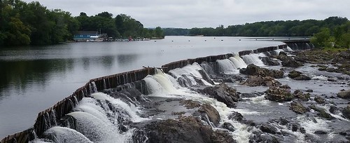
Pawtucket Falls on Merrimack River
On Thursday, August 27, 2020, I logged on to “Lowell Lines District Mapping Info Session,” an online forum hosted by CMAA, Massachusetts Voter Table, Lowell Alliance, and Latinx Community Center for Empowerment (LCCE). The purpose of the session was to gather information for the creation of new voting districts in advance of next year’s city election.
That redistricting is mandated by the settlement of a lawsuit brought against the city by a number of residents who alleged that the city’s winner-take-all method of electing councilors unfairly diluted the votes of minority residents in violation of the federal Voting Rights Act. The parties settled the case by agreeing to a new method of electing councilors and school committee members. The Court ratified the settlement and retained jurisdiction over the case to monitor compliance.
The new electoral format which will be used in the November 2021 city election has eleven city councilors with three elected citywide and eight elected from individual districts, two of which will contain a majority of minority residents. The school committee will remain at six elected members with two elected citywide and four elected from districts, one of which must be majority minority. Each school committee district will consist of two city council districts. The city council will elect a mayor by majority vote of the eleven elected members, and the mayor will serve on the school committee as is the case now.
During the August 27 Zoom conference participants learned that the city has retained Nathaniel Persily, a Professor of Law at Stanford Law School to oversee the drawing of the new districts. The organizers of the conference stressed that information from people who live and work in the city about how the city is already organized and operates will be considered by Professor Persily.
With that in mind, I thought I would spend the rest of this post sharing my understanding of the various sections of Lowell, making use of today’s neighborhood names and other commonly-known landmarks to help build a verbal map of the city.
Any analysis of Lowell’s neighborhoods should begin with the city’s geography and its history. The most prominent terrain features are the city’s two rivers, the Merrimack and the Concord. As it passes through Lowell, the Merrimack flows from west to east with the neighborhoods of Centralville and Pawtucketville on the north side of the river and the rest of the city to the south. The Concord River originates near the town of Concord then flows north until it joins the Merrimack in a T-shaped intersection. To the east of the Concord is the Belvidere neighborhood; to the west is South Lowell and Downtown.
Lowell received it town charter in 1826 and a city charter in 1836. The physical size of the city then was much less than it is now. Originally, Lowell consisted of today’s Downtown, the Acre, and the Lower Highlands. Roughly speaking, the northern boundary was the Merrimack River; the eastern boundary was the Concord River; the southern boundary was the town of Billerica; and the western boundary was Stevens Street (which is today considered the boundary between the Upper and Lower Highlands).
Over time, the State Legislature annexed portions of the adjacent towns of Dracut, Tewksbury and Chelmsford to Lowell to enlarge the city’s geographic footprint. Although it may be hard to imagine this from our 21st century perspective, the people who lived in the areas that were annexed to the city for the most part supported the change.
On February 28, 1851, lower Centralville was formed with 580 acres annexed from Dracut. This area was bounded to the north by the line of Aiken-Ennell-Richardson-Thirteenth Streets; to the east by the Dracut town line; and to the south and west by the Merrimack River.
Two more annexations occurred on May 18, 1874. The largest was 2,168 acres north of the Merrimack River taken from Dracut to form Pawtucketville and the remainder of Centralville. The second annexation was 1,129 acres taken from Chelmsford to form the rest of the Highlands. This included everything west of Stevens Street, bounded by the Chelmsford town line to the south and west and the Merrimack River to the north.
The final two annexations took land from Tewksbury to form the rest of Belvidere. The first, on May 17, 1888, was a half moon-shaped slice of 220 acres that ran along Butman Road to Stratham Street. The second, on April 30, 1906, added the rest of today’s Belvidere and South Lowell.
While Lowell’s current boundaries were finalized in 1906, there is nothing final about the names of the city’s neighborhoods or their boundaries. Before exploring some of these nuances, let me suggest a framework for visualizing the main neighborhoods of the city: Think of the city as the face of a clock.
At the center is downtown which initially contained only the textile mills and company-owned housing for those who worked in the mills. However, many retail, commercial, financial and religious buildings were soon added. In the 1980s, as businesses left the city core, the upper floors of many downtown buildings were converted to housing units making downtown a residential neighborhood as well as the city’s central business district. At the start of the twenty-first century, the city embraced the “creative economy” for downtown with mixed results.
At the 12 o’clock position is Centralville. An early subdivision plan recorded at the Registry of Deeds refers to some of this area as “Central Village” which I suspect is the basis of the neighborhood’s name. Centralville’s proximity to the mills just across the river made this an attractive place for worker housing once the bridge across the Merrimack was constructed on Bridge Street.
Moving clockwise to the 3 o’clock position, we have Belvidere. Bounded by the Merrimack River to the north, Tewksbury to the east, Billerica to the south and the Concord River to the west, Belvidere contains single family housing that ranges from mansion-like structures built for mill executives to more modest single family homes with spacious yards. The subneighborhood known as Lower Belvidere runs from the Concord River to the west to Nesmith Street to the east. This wedge is dominated by multifamily housing.
Continuing around the clock to the 6 o’clock position is a collection of neighborhoods and sub-neighborhoods that I’ll call South Lowell although its components are known variously as Chapel Hill, Back Central, Sacred Heart, the Flats, the Bleachery, the Grove, Swede Village, the South End, Riverside Park and Wigginville. This cluster is bordered to the north by Church Street and Downtown; to the east by the Concord River; to the south by East Chelmsford and Billerica; and to the west by Gorham Street. Although it is now largely residential, there was once considerable heavy industry along the banks of the Concord River.
At the 8 o’clock position is the Highlands, another of the city’s large residential neighborhoods. This neighborhood’s northern boundary is the Merrimack River and the Acre neighborhood; its boundary to the east is Thorndike/Gorham Street; and the Chelmsford town line to the south and west. Initially part of Chelmsford, much of what is now known as the “Lower Highlands” was part of the original 1826 Lowell grant. (Draw a line form UMass Lowell South Campus to Cross Point to get an idea of the original boundary). The rest of the Highlands including Middlesex Village was annexed from Chelmsford in 1874.
At a close-in 9 o’clock position is the Acre neighborhood. The entrepreneurs who conceived the great textile mills were immediately joined by Irish immigrants who did the back-breaking work of digging the canals and building the mills. The mill owners granted these immigrants an acre of land just to the west of downtown to use for housing and so the neighborhood became known as The Acre. Initially settled by Irish immigrants, it has always been the first stop for many of Lowell’s newest residents.
Finally at the 10 o’clock position is Pawtucketville. The northern boundary of this neighborhood is Dracut; to the east is Centralville; to the south is the Merrimack River; and to the west is Tyngsborough. When it was first made part of Lowell in 1874, Pawtucketville was mostly farm and woodland with its greatest value coming from its fresh water wells which supplied the city with clean drinking water for a time. Today, Pawtucketville is predominantly a neighborhood of single family homes.
A map in Sustainable Lowell 2025, the city’s ten year master plan, identified eleven neighborhoods: the Acre, Back Central, Belvidere, Centralville, Downtown, Highlands, Lower Belvidere, Lower Highlands, Pawtucketville, Sacred Heart, and South Lowell. Many would disagree with this list. Some recognize no distinction between the upper and lower Highlands or upper and lower Belvidere. Others know Back Central as Chapel Hill and see Sacred Heart as a parish and not a neighborhood, calling the whole section South Lowell. Ayers City is wedged between the Highlands and South Lowell but claimed by neither. Middlesex Village predated Lowell by almost two centuries but it has been lumped in with the Highlands and has lost its independent identity.
A map created by Lowell historian Mehmed Ali includes all of these and adds several other subneighborhoods. On this map, Centralville includes Christian Hill, Jersey, West Centralville and Rosemont Terrace. The Acre has Little Canada and Uptown. The Highlands has Scotchtown, Gageville, and Hale-Howard. And Belvidere has The Oaklands, Atherton Village, and Belvidere Hill.
Like an archeological dig, identifying Lowell’s neighborhoods is a never-ending process. The more we dig into old and new maps, plans, deeds, newspaper articles, oral histories, and other sources, the more our knowledge of these familiar and unfamiliar names will be enhanced.
Richard, thank you so much for this excellent description of our city’s neighborhoods. I’ve lived in the Flats all my life and I can’t imagine not identifying it as such. Growing up in 50’s and 60’s Lowell, your neighborhood was part of your identity…..
Thanks, Ray. I agree that neighborhood was central to your Lowell identity for a very long time. How that came about, what it was like, and why it has changed are all topics of interest to me that I hope to explore in future posts.
This is so interesting. Thank you.
I loved this lesson in Lowell’s neighborhoods! Thank you for the clock analogy…made it easier to visualize! Great job!